Topic starter
17/06/2016 1:08 pm
Morning all,
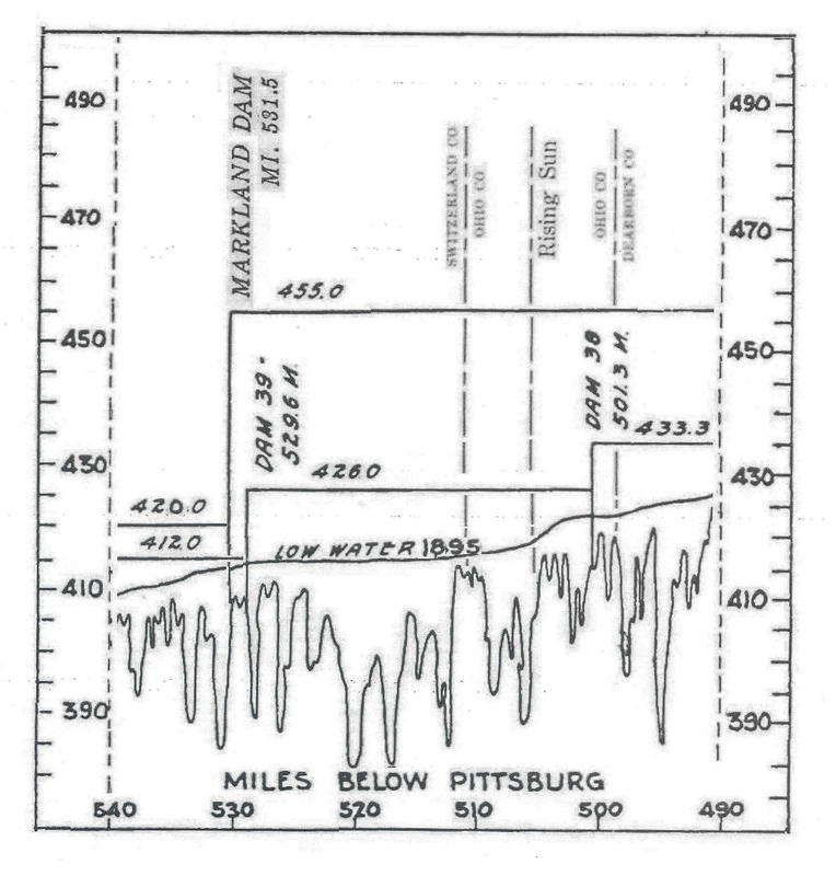
My, how the river has changed over the years. The attached image is a compilation made from contemporary river charts. The same can be said for the length of the river.
The 1895 low water line stopped all but the shallowest draft steamboats. The 426.0 line shows how much water there was to play with with the completion of the first set of dams. The 455.0 line shows the water level today after the second set of dams was completed.
There are three images showing the effect of these water levels about mile 503.0 on my web page theryles.com. The earliest shows the wharf boat with the City of Louisville approaching about 1910. The book back cover was taken about 1930. The book front cover was taken by me in 2013.
Yep, same stretch of river more or less. Yep, how folks utilized the river has changed over the years. Yep, the river still runs through their lives.
Keep your steam up!
Russ Ryle